Map of the mining district of Rossie, issued between 1837 and 1843. The map measures 30 x 18 cm on a sheet of 45 x 37 cm. It is associated with mines and mineral resources in Rossie, New York, and was published by an unidentified publisher. The place of publication is noted to be Albany, N.Y
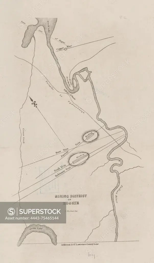
SuperStock offers millions of photos, videos, and stock assets to creatives around the world. This image of Map of the mining district of Rossie, issued between 1837 and 1843. The map measures 30 x 18 cm on a sheet of 45 x 37 cm. It is associated with mines and mineral resources in Rossie, New York, and was published by an unidentified publisher. The place of publication is noted to be Albany, N.Y by Artokoloro is available for licensing today.
Looking for a license?
Click here, and we'll help you find it! Questions? Just ask!
Click here, and we'll help you find it! Questions? Just ask!
DETAILS
Image Number: 4443-75465144Rights ManagedCredit Line:Artokoloro/SuperStockCollection:Artokoloro Model Release:NoProperty Release:NoResolution:4478×7602