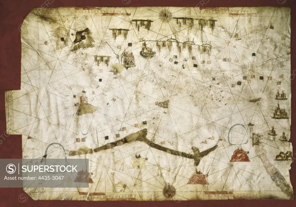
Map of the Mediterranean (Add.Ms. 25691). It is probably the oldest portolan chart from the school of Mallorca ca. 1327-1330. Are represented Italy, Sicily and North Africa. Miniature Painting. UNITED KINGDOM. ENGLAND. London. The British Museum.
SuperStock offers millions of photos, videos, and stock assets to creatives around the world. This image of Map of the Mediterranean (Add.Ms. 25691). It is probably the oldest portolan chart from the school of Mallorca ca. 1327-1330. Are represented Italy, Sicily and North Africa. Miniature Painting. UNITED KINGDOM. ENGLAND. London. The British Museum. by Iberfoto Archivo/Iberfoto is available for licensing today.
Looking for a license?
Click here, and we'll help you find it! Questions? Just ask!
Click here, and we'll help you find it! Questions? Just ask!
DETAILS
Image Number: 4435-3047Rights ManagedCredit Line:Iberfoto Archivo/Iberfoto/SuperStockCollection:Iberfoto Archivo Model Release:NoProperty Release:NoResolution:5010×3508