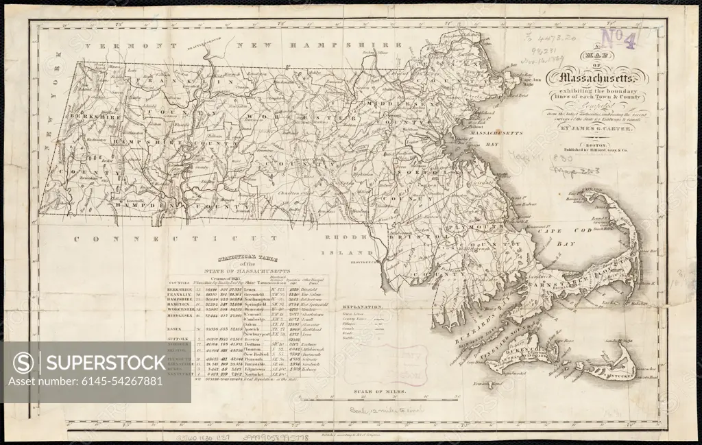
A map of Massachusetts, exhibiting the boundary lines of each town and county : compiled from the latest authorities, embracing the recent surveys of the State for railways and canals. Relief shown by hachures. Includes statistical table of the state of Massachusetts.... , Massachusetts
SuperStock offers millions of photos, videos, and stock assets to creatives around the world. This image of A map of Massachusetts, exhibiting the boundary lines of each town and county : compiled from the latest authorities, embracing the recent surveys of the State for railways and canals. Relief shown by hachures. Includes statistical table of the state of Massachusetts.... , Massachusetts by piemags/PL Photography Limited is available for licensing today.
Looking for a license?
Click here, and we'll help you find it! Questions? Just ask!
Click here, and we'll help you find it! Questions? Just ask!
DETAILS
Image Number: 6145-54267881Royalty FreeCredit Line:piemags/PL Photography Limited/SuperStockCollection:PL Photography Limited Story:19th Century U.S. MapsContributor:piemags Model Release:NoProperty Release:NoResolution:4743×3009