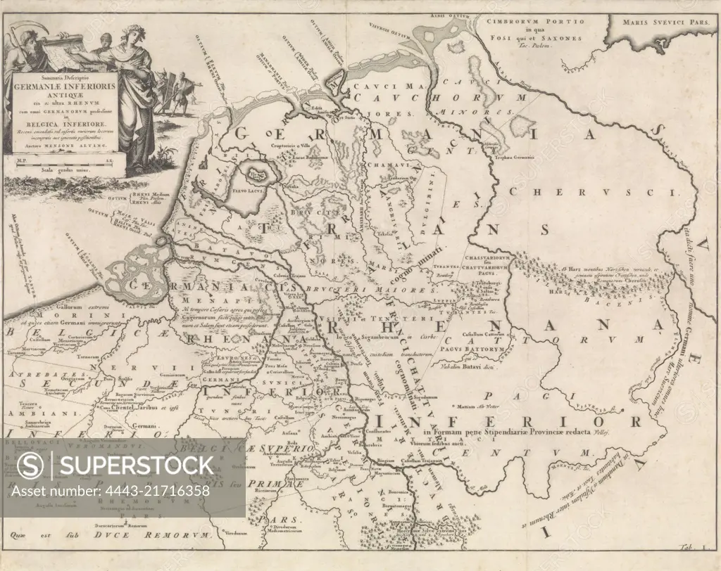
Map marked at lower right: Tab. I., Historical map of the Netherlands in the time of the Frisians, Franks and Saxons I Summaria Descriptio Germaniae Inferioris Antiquae , print maker: Jan Luyken, publisher: Henricus Wetstein, Amsterdam, 1697, paper, etching, h 340 mm × w 422 mm
SuperStock offers millions of photos, videos, and stock assets to creatives around the world. This image of Map marked at lower right: Tab. I., Historical map of the Netherlands in the time of the Frisians, Franks and Saxons I Summaria Descriptio Germaniae Inferioris Antiquae , print maker: Jan Luyken, publisher: Henricus Wetstein, Amsterdam, 1697, paper, etching, h 340 mm × w 422 mm by Artokoloro is available for licensing today.
Looking for a license?
Click here, and we'll help you find it! Questions? Just ask!
Click here, and we'll help you find it! Questions? Just ask!
DETAILS
Image Number: 4443-21716358Rights ManagedCredit Line:Artokoloro/SuperStockCollection:Artokoloro Model Release:NoProperty Release:NoResolution:7084×5620