Map of the manors erected within the county of Westchester, compiled from manor grants and ancient maps, issued in 1886 by L.E. Preston & Co. This hand-colored map measures 28 x 25 cm and illustrates land grants, real property, and administrative divisions in Westchester County, New York. The map was published in Philadelphia
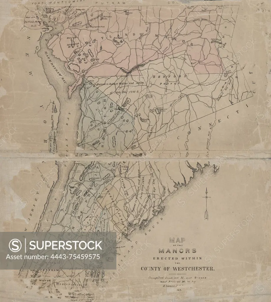
SuperStock offers millions of photos, videos, and stock assets to creatives around the world. This image of Map of the manors erected within the county of Westchester, compiled from manor grants and ancient maps, issued in 1886 by L.E. Preston & Co. This hand-colored map measures 28 x 25 cm and illustrates land grants, real property, and administrative divisions in Westchester County, New York. The map was published in Philadelphia by Artokoloro is available for licensing today.
Looking for a license?
Click here, and we'll help you find it! Questions? Just ask!
Click here, and we'll help you find it! Questions? Just ask!
DETAILS
Image Number: 4443-75459575Rights ManagedCredit Line:Artokoloro/SuperStockCollection:Artokoloro Model Release:NoProperty Release:NoResolution:5125×5700