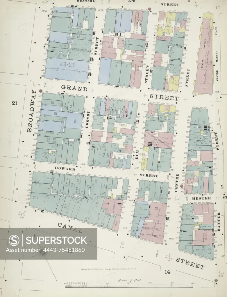
Map of Manhattan, Volume 1, Plate No. 23 (west half), featuring an area bounded by Broome Street, Baxter Street, Canal Street, and Broadway. Issued by the Sanborn Map Company, the map dates from 1884 to 1894 and focuses on fire insurance details relevant to real property in New York State, including cities and towns
SuperStock offers millions of photos, videos, and stock assets to creatives around the world. This image of Map of Manhattan, Volume 1, Plate No. 23 (west half), featuring an area bounded by Broome Street, Baxter Street, Canal Street, and Broadway. Issued by the Sanborn Map Company, the map dates from 1884 to 1894 and focuses on fire insurance details relevant to real property in New York State, including cities and towns by Artokoloro is available for licensing today.
Looking for a license?
Click here, and we'll help you find it! Questions? Just ask!
Click here, and we'll help you find it! Questions? Just ask!
DETAILS
Image Number: 4443-75461860Rights ManagedCredit Line:Artokoloro/SuperStockCollection:Artokoloro Model Release:NoProperty Release:NoResolution:5002×6558