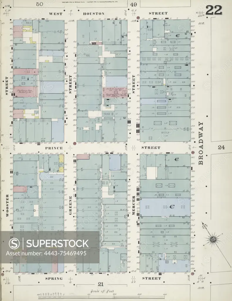
Map of Manhattan, Volume 1, Plate No. 22, bounded by W. Houston St., Broadway, Spring St., and Wooster St. Issued by the Sanborn Map Company between 1884 and 1894. The map is focused on New York City and includes details relevant to fire insurance and real property in the area
SuperStock offers millions of photos, videos, and stock assets to creatives around the world. This image of Map of Manhattan, Volume 1, Plate No. 22, bounded by W. Houston St., Broadway, Spring St., and Wooster St. Issued by the Sanborn Map Company between 1884 and 1894. The map is focused on New York City and includes details relevant to fire insurance and real property in the area by Artokoloro is available for licensing today.
Looking for a license?
Click here, and we'll help you find it! Questions? Just ask!
Click here, and we'll help you find it! Questions? Just ask!
DETAILS
Image Number: 4443-75469495Rights ManagedCredit Line:Artokoloro/SuperStockCollection:Artokoloro Model Release:NoProperty Release:NoResolution:5032×6519