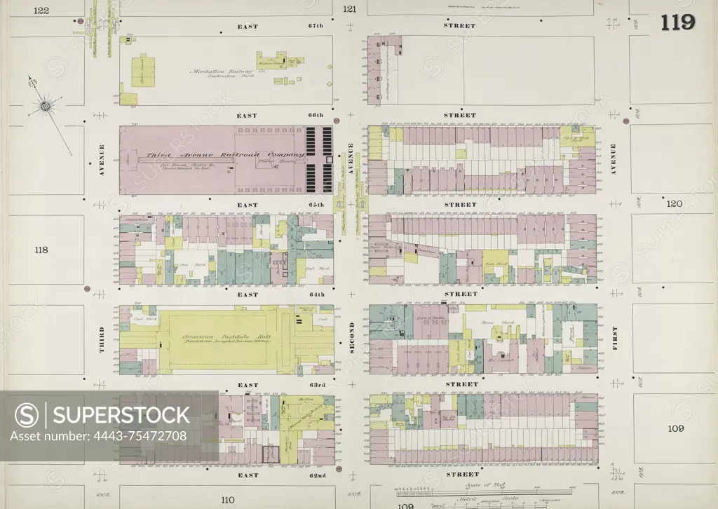
Map of Manhattan, Volume 6, Double Page Plate No. 119, bounded by E. 67th St., 1st Ave., E. 62nd St., and 3rd Ave. Issued by the Sanborn Map Company between 1884 and 1892. The map is used for fire insurance purposes and depicts real property in New York City
SuperStock offers millions of photos, videos, and stock assets to creatives around the world. This image of Map of Manhattan, Volume 6, Double Page Plate No. 119, bounded by E. 67th St., 1st Ave., E. 62nd St., and 3rd Ave. Issued by the Sanborn Map Company between 1884 and 1892. The map is used for fire insurance purposes and depicts real property in New York City by Artokoloro is available for licensing today.
Looking for a license?
Click here, and we'll help you find it! Questions? Just ask!
Click here, and we'll help you find it! Questions? Just ask!
DETAILS
Image Number: 4443-75472708Rights ManagedCredit Line:Artokoloro/SuperStockCollection:Artokoloro Model Release:NoProperty Release:NoResolution:6539×4640