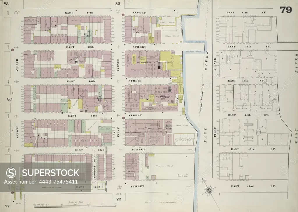
Map of Manhattan, Volume 4, Double Page Plate No. 79, bounded by East 47th Street, East River, East 42nd Street, and 2nd Avenue. Issued by the Sanborn Map Company, this map dates from 1884 to 1899 and focuses on fire insurance and real property in New York, specifically within the cities and towns of New York State
SuperStock offers millions of photos, videos, and stock assets to creatives around the world. This image of Map of Manhattan, Volume 4, Double Page Plate No. 79, bounded by East 47th Street, East River, East 42nd Street, and 2nd Avenue. Issued by the Sanborn Map Company, this map dates from 1884 to 1899 and focuses on fire insurance and real property in New York, specifically within the cities and towns of New York State by Artokoloro is available for licensing today.
Looking for a license?
Click here, and we'll help you find it! Questions? Just ask!
Click here, and we'll help you find it! Questions? Just ask!
DETAILS
Image Number: 4443-75475411Rights ManagedCredit Line:Artokoloro/SuperStockCollection:Artokoloro Model Release:NoProperty Release:NoResolution:6572×4680