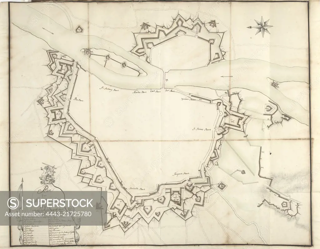
Map of Maastricht, ca. 1701-1715, Samuel Du Ry de Champdoré, 1701 - 1715, Map of the fortifications around the city of Maastricht and Wyck, ca. 1701-1715. Bottom left a cartouche with legend 1-29 in Dutch. Part of a collection of drawn plans of fortified towns in the Netherlands and surrounding countries at the time of the War of the Spanish Succession (part B)., draughtsman: Samuel Du Ry de Champdoré, Netherlands, 1701 - 1715, paper, h 640 mm × w 780 mm
SuperStock offers millions of photos, videos, and stock assets to creatives around the world. This image of Map of Maastricht, ca. 1701-1715, Samuel Du Ry de Champdoré, 1701 - 1715, Map of the fortifications around the city of Maastricht and Wyck, ca. 1701-1715. Bottom left a cartouche with legend 1-29 in Dutch. Part of a collection of drawn plans of fortified towns in the Netherlands and surrounding countries at the time of the War of the Spanish Succession (part B)., draughtsman: Samuel Du Ry de Champdoré, Netherlands, 1701 - 1715, paper, h 640 mm × w 780 mm by Artokoloro is available for licensing today.
Looking for a license?
Click here, and we'll help you find it! Questions? Just ask!
Click here, and we'll help you find it! Questions? Just ask!
DETAILS
Image Number: 4443-21725780Rights ManagedCredit Line:Artokoloro/SuperStockCollection:Artokoloro Model Release:NoProperty Release:NoResolution:5720×4460