Map of Louisiana and the Mississippi River, created from various sources, including those of Mr. le Maire, issued in 1730. Published in Amsterdam by Jean Cóvens and Corneille Mortier, geographers. The map is hand-colored and measures 42 x 58 cm
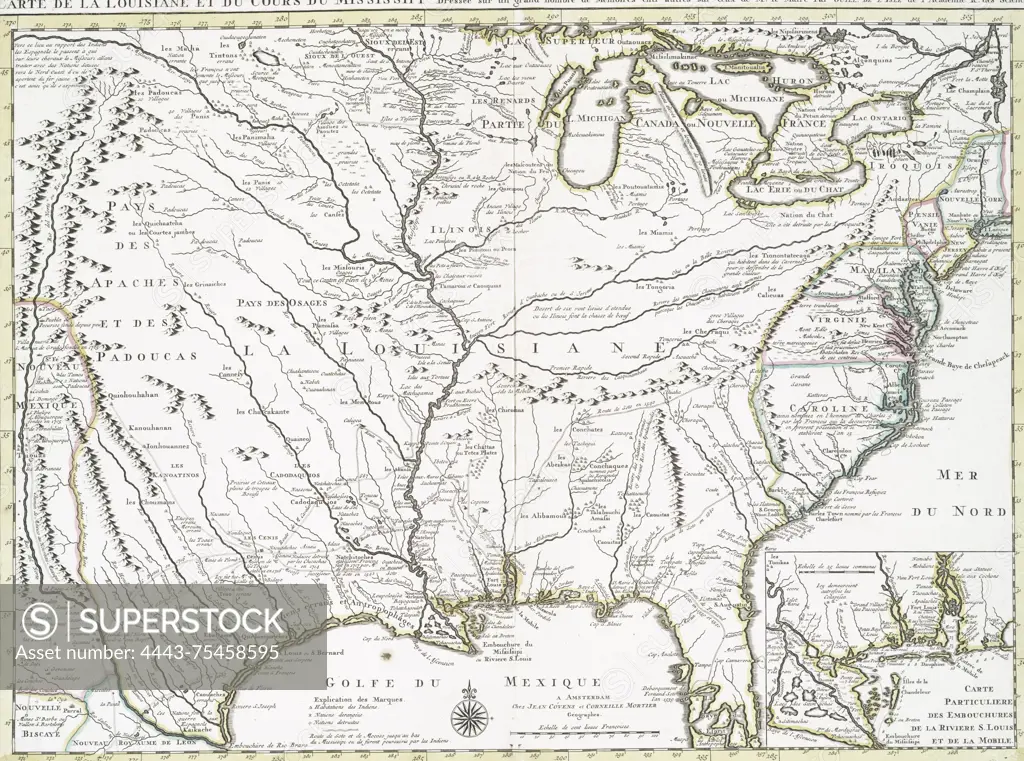
SuperStock offers millions of photos, videos, and stock assets to creatives around the world. This image of Map of Louisiana and the Mississippi River, created from various sources, including those of Mr. le Maire, issued in 1730. Published in Amsterdam by Jean Cóvens and Corneille Mortier, geographers. The map is hand-colored and measures 42 x 58 cm by Artokoloro is available for licensing today.
Looking for a license?
Click here, and we'll help you find it! Questions? Just ask!
Click here, and we'll help you find it! Questions? Just ask!
DETAILS
Image Number: 4443-75458595Rights ManagedCredit Line:Artokoloro/SuperStockCollection:Artokoloro Model Release:NoProperty Release:NoResolution:4065×3022