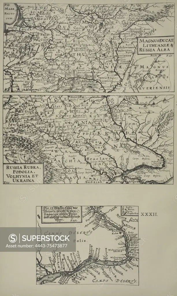
A map of Lithuania published by Ia. Sandrart in 1899, based on a map of Poland by G. de Boplan. The map features cartographic details relevant to the geography and history of Lithuania during that period. Published in Kiev by Tip. S.V. Kulʹzhenko, it serves as a historical representation of the region
SuperStock offers millions of photos, videos, and stock assets to creatives around the world. This image of A map of Lithuania published by Ia. Sandrart in 1899, based on a map of Poland by G. de Boplan. The map features cartographic details relevant to the geography and history of Lithuania during that period. Published in Kiev by Tip. S.V. Kulʹzhenko, it serves as a historical representation of the region by Artokoloro is available for licensing today.
Looking for a license?
Click here, and we'll help you find it! Questions? Just ask!
Click here, and we'll help you find it! Questions? Just ask!
DETAILS
Image Number: 4443-75473877Rights ManagedCredit Line:Artokoloro/SuperStockCollection:Artokoloro Model Release:NoProperty Release:NoResolution:3799×6343