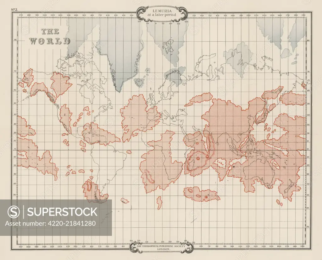
A map of Lemuria at its greatest extent Date: 1904
SuperStock offers millions of photos, videos, and stock assets to creatives around the world. This image of Explore the Fascinating Antiquity of Polar-Azimuthal Equidistant Projection Maps: A Historical Worldview by Mary Evans Picture Library/Pantheon is available for licensing today.
Looking for a license?
Click here, and we'll help you find it! Questions? Just ask!
Click here, and we'll help you find it! Questions? Just ask!
DETAILS
Image Number: 4220-21841280Rights ManagedCredit Line:Mary Evans Picture Library/Pantheon/SuperStockCollection:Mary Evans Picture Library Model Release:NoProperty Release:NoResolution:4183×3389