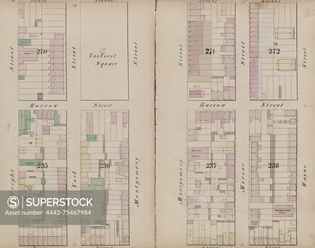
Map of Jersey City from 1866, created by I.B. Culver & Co. The map is bounded by Jersey Avenue, Wayne Street, Grove Street, and Bright Street. It is part of Volume 1 and is identified as Double Page Plate No. 20. The map is related to fire insurance in New Jersey
SuperStock offers millions of photos, videos, and stock assets to creatives around the world. This image of Map of Jersey City from 1866, created by I.B. Culver & Co. The map is bounded by Jersey Avenue, Wayne Street, Grove Street, and Bright Street. It is part of Volume 1 and is identified as Double Page Plate No. 20. The map is related to fire insurance in New Jersey by Artokoloro is available for licensing today.
Looking for a license?
Click here, and we'll help you find it! Questions? Just ask!
Click here, and we'll help you find it! Questions? Just ask!
DETAILS
Image Number: 4443-75467984Rights ManagedCredit Line:Artokoloro/SuperStockCollection:Artokoloro Model Release:NoProperty Release:NoResolution:5700×4489