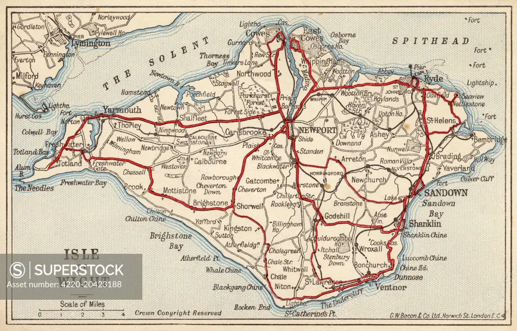
Map of the Isle of Wight, showing the principal roads (marked in red) and the internal Island rail network Date: 1910
SuperStock offers millions of photos, videos, and stock assets to creatives around the world. This image of Explore the Historic Beauty of the Isle of Wight with This Vintage Map - Discover Key Locations and Travel Routes by Grenville Collins/Mary Evans Picture Library/Pantheon is available for licensing today.
Looking for a license?
Click here, and we'll help you find it! Questions? Just ask!
Click here, and we'll help you find it! Questions? Just ask!
DETAILS
Image Number: 4220-20423188Rights ManagedCredit Line:Grenville Collins/Mary Evans Picture Library/Pantheon/SuperStockCollection:Mary Evans Picture Library Contributor:Grenville Collins Model Release:NoProperty Release:NoResolution:5352×3433