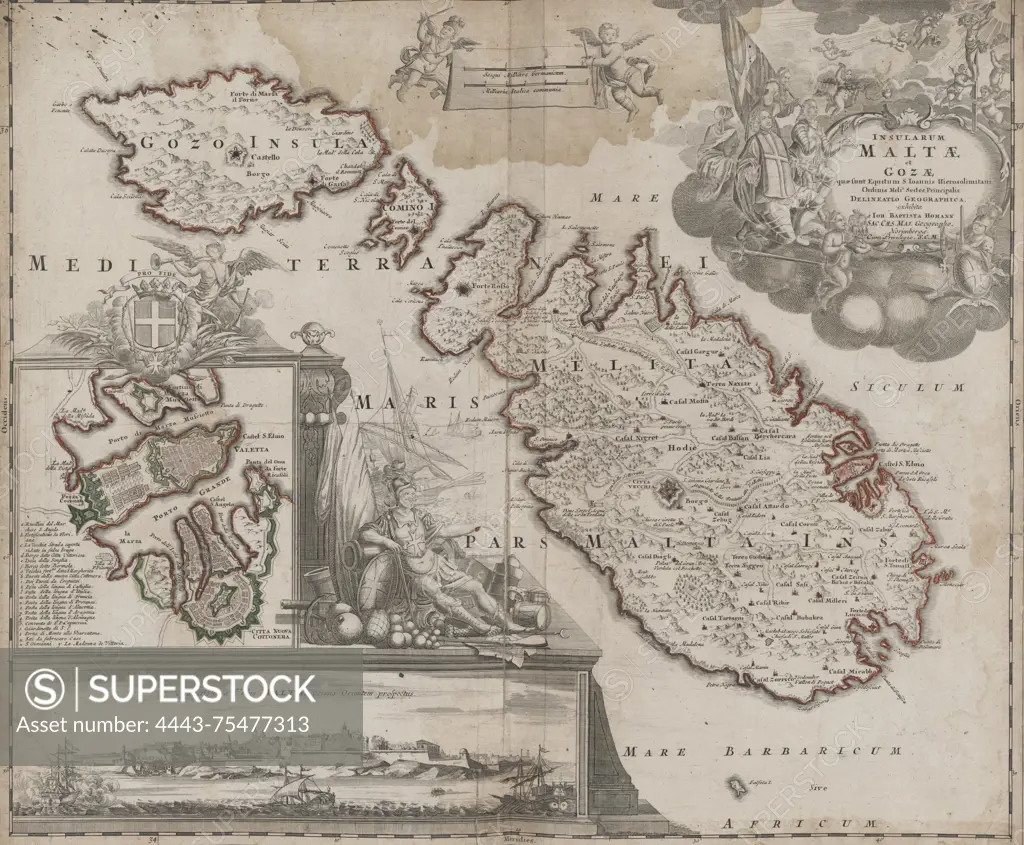
Map of the Islands of Malta and Gozo, created between 1731 and 1798, located in Nuremberg, Italy. The map measures 50 cm in extent
SuperStock offers millions of photos, videos, and stock assets to creatives around the world. This image of Map of the Islands of Malta and Gozo, created between 1731 and 1798, located in Nuremberg, Italy. The map measures 50 cm in extent by Artokoloro is available for licensing today.
Looking for a license?
Click here, and we'll help you find it! Questions? Just ask!
Click here, and we'll help you find it! Questions? Just ask!
DETAILS
Image Number: 4443-75477313Rights ManagedCredit Line:Artokoloro/SuperStockCollection:Artokoloro Model Release:NoProperty Release:NoResolution:5700×4705