A map of Ireland, divided into its four provinces and further subdivided into counties. Published by Robert Sayer in London in 1788, this is the second edition with additions, corrections, and significant improvements. The map is part of a collection of early works on British geography
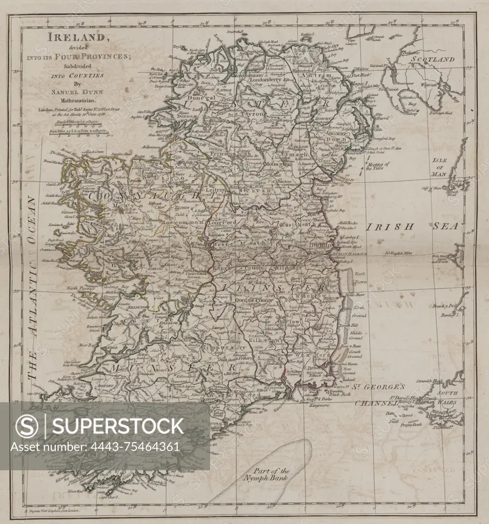
SuperStock offers millions of photos, videos, and stock assets to creatives around the world. This image of A map of Ireland, divided into its four provinces and further subdivided into counties. Published by Robert Sayer in London in 1788, this is the second edition with additions, corrections, and significant improvements. The map is part of a collection of early works on British geography by Artokoloro is available for licensing today.
Looking for a license?
Click here, and we'll help you find it! Questions? Just ask!
Click here, and we'll help you find it! Questions? Just ask!
DETAILS
Image Number: 4443-75464361Rights ManagedCredit Line:Artokoloro/SuperStockCollection:Artokoloro Model Release:NoProperty Release:NoResolution:5027×5391