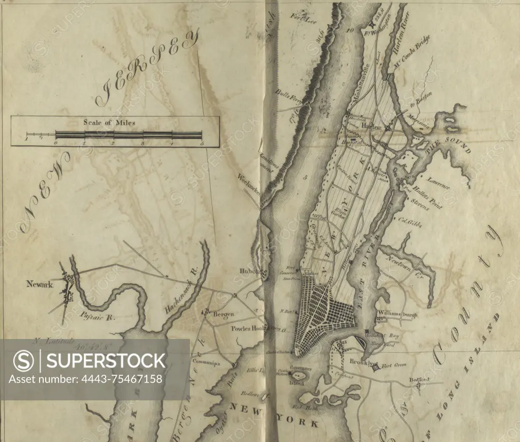
Map of the Hudson River from New York Harbor to Fort Washington, published by A.T. Goodrich in 1820. The map depicts the Hudson River Valley, including details relevant to New York and New Jersey, as well as post roads in New York State
SuperStock offers millions of photos, videos, and stock assets to creatives around the world. This image of Map of the Hudson River from New York Harbor to Fort Washington, published by A.T. Goodrich in 1820. The map depicts the Hudson River Valley, including details relevant to New York and New Jersey, as well as post roads in New York State by Artokoloro is available for licensing today.
Looking for a license?
Click here, and we'll help you find it! Questions? Just ask!
Click here, and we'll help you find it! Questions? Just ask!
DETAILS
Image Number: 4443-75467158Rights ManagedCredit Line:Artokoloro/SuperStockCollection:Artokoloro Model Release:NoProperty Release:NoResolution:3213×2734