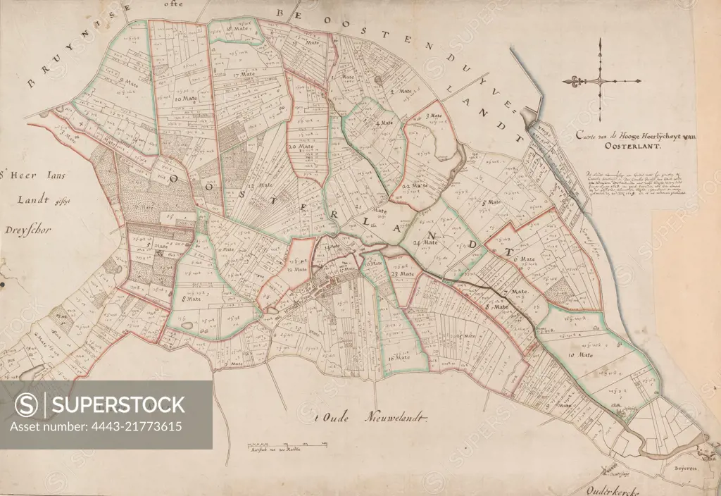
Map of the high glory Oosterland, located on Duiveland. Bottom left of the middle a scale stick: Maetstock of 200 rods. Top right the title and below that information about the map. Map made by order of the lords of Oosterland following the flooding of the polders Zonneschijn and Hardemee in 1629, one year after these polders had been diked and just after the area had been measured and mapped by surveyors Cornelis Stavenisse and Jan Cornelis Jacobsz., Map of the high seigniory of Oosterland Caerte from the high seigniory of Oosterlant., draughtsman: anonymous, Cornelis Stavenisse, (mentioned on object), Jan Cornelis Jacobsz., (mentioned on object), 1629, paper, pen, brush, h 492 mm × w 716 mm
SuperStock offers millions of photos, videos, and stock assets to creatives around the world. This image of Map of the high glory Oosterland, located on Duiveland. Bottom left of the middle a scale stick: Maetstock of 200 rods. Top right the title and below that information about the map. Map made by order of the lords of Oosterland following the flooding of the polders Zonneschijn and Hardemee in 1629, one year after these polders had been diked and just after the area had been measured and mapped by surveyors Cornelis Stavenisse and Jan Cornelis Jacobsz., Map of the high seigniory of Oosterland Caerte from the high seigniory of Oosterlant., draughtsman: anonymous, Cornelis Stavenisse, (mentioned on object), Jan Cornelis Jacobsz., (mentioned on object), 1629, paper, pen, brush, h 492 mm × w 716 mm by Artokoloro is available for licensing today.
Looking for a license?
Click here, and we'll help you find it! Questions? Just ask!
Click here, and we'll help you find it! Questions? Just ask!
DETAILS
Image Number: 4443-21773615Rights ManagedCredit Line:Artokoloro/SuperStockCollection:Artokoloro Model Release:NoProperty Release:NoResolution:6029×4147