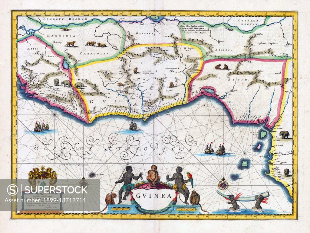
Map of Guinea and surrounding regions. The Benin Kingdom is indicated in the east. Amsterdam, Blaeu, J. & G. 1640-50.
SuperStock offers millions of photos, videos, and stock assets to creatives around the world. This image of Map of Guinea and surrounding regions. The Benin Kingdom is indicated in the east. Amsterdam, Blaeu, J. & G. 1640-50. by Pictures From History/Universal Images is available for licensing today.
Looking for a license?
Click here, and we'll help you find it! Questions? Just ask!
Click here, and we'll help you find it! Questions? Just ask!
DETAILS
Image Number: 1899-18718714Rights ManagedCredit Line:Pictures From History/Universal Images/SuperStockCollection:Universal Images Contributor:Pictures From History Model Release:NoProperty Release:NoResolution:5000×3774