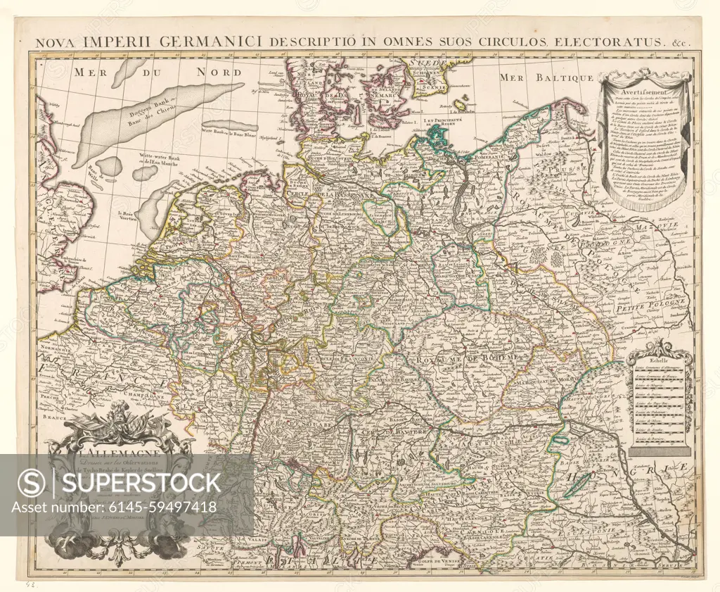
Map of Germany, Guillaume Delisle, 1685 - 1726 Map from Germany from Belgrade to Calais, Borders colored, rimmed yellow. Inscription L.O. Surrounded by weapons and trumpet -blowing angels. R.B. 'Avertissement' with explanation. R.o. Scale in German, French, Hungarian, Swiss, Dutch, Palatine, Hessian, Schwabian and Bavarian miles (1: 2.5 million). Inscription; B: Nova Imperii Germanici Descriptio in Omes Suos Circulos Electoratus & C. L.O.: L'Altemagne / Dressée sur les Observations / the Tycho-Brahé de Kepler de Snellius. Signed. Amsterdam paper engraving maps of separate countries or regions Netherlands. Germany. Switzerland
SuperStock offers millions of photos, videos, and stock assets to creatives around the world. This image of Map of Germany, Guillaume Delisle, 1685 - 1726 Map from Germany from Belgrade to Calais, Borders colored, rimmed yellow. Inscription L.O. Surrounded by weapons and trumpet -blowing angels. R.B. 'Avertissement' with explanation. R.o. Scale in German, French, Hungarian, Swiss, Dutch, Palatine, Hessian, Schwabian and Bavarian miles (1: 2.5 million). Inscription; B: Nova Imperii Germanici Descriptio in Omes Suos Circulos Electoratus & C. L.O.: L'Altemagne / Dressée sur les Observations / the Tycho-Brahé de Kepler de Snellius. Signed. Amsterdam paper engraving maps of separate countries or regions Netherlands. Germany. Switzerland by Piemags/PL Photography Limited is available for licensing today.
DETAILS
Image Number: 6145-59497418Royalty FreeCredit Line:Piemags/PL Photography Limited/SuperStockCollection: