Map of Genesee County, New York, published in 1854 by John E. Gillette. The hand-colored map measures 95 x 131 cm and features landowners, villages, and statistics related to Batavia and other areas within Genesee County
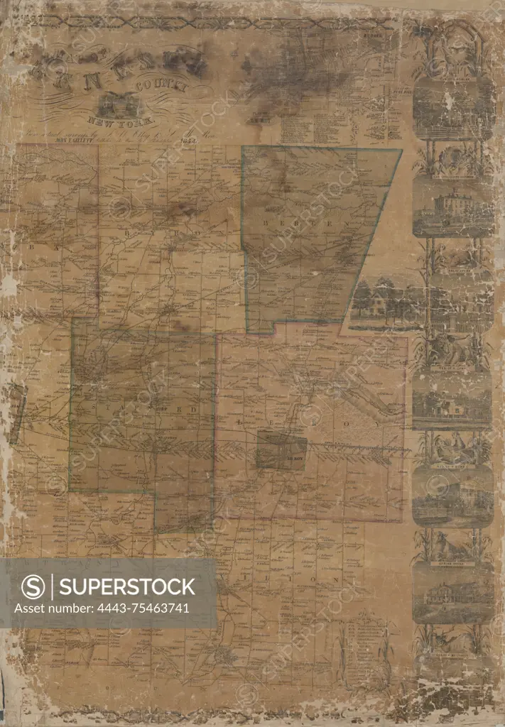
SuperStock offers millions of photos, videos, and stock assets to creatives around the world. This image of Map of Genesee County, New York, published in 1854 by John E. Gillette. The hand-colored map measures 95 x 131 cm and features landowners, villages, and statistics related to Batavia and other areas within Genesee County by Artokoloro is available for licensing today.
Looking for a license?
Click here, and we'll help you find it! Questions? Just ask!
Click here, and we'll help you find it! Questions? Just ask!
DETAILS
Image Number: 4443-75463741Rights ManagedCredit Line:Artokoloro/SuperStockCollection:Artokoloro Model Release:NoProperty Release:NoResolution:3961×5700