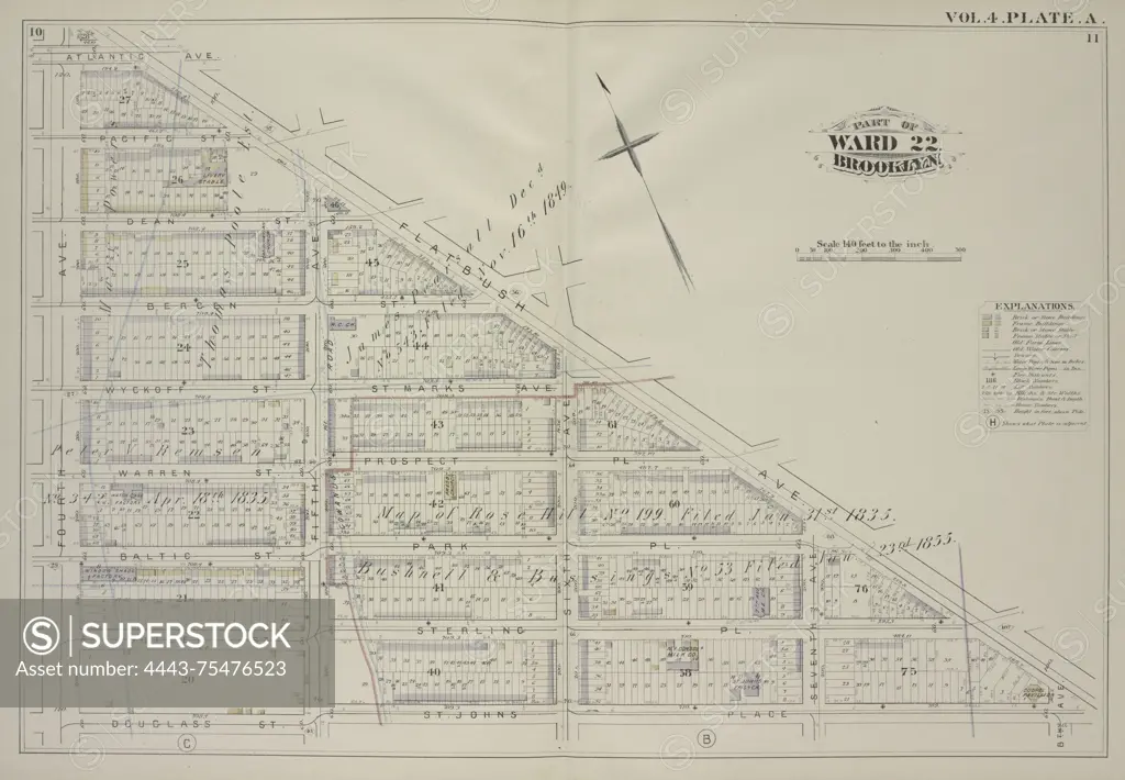
A map from Volume 4, Plate A, depicting an area bound by Atlantic Avenue, Flatbush Avenue, St. Johns Place, and Douglass Street. The map includes streets such as Pacific Street, Dean Street, Berg Street, Wyckoff Street, St. Marks Avenue, Warren Street, Prospect Place, Baltic Street, Park Place, Butler Street, Sterling Place, Fifth Avenue, Sixth Avenue, Seventh Avenue, and Eighth Avenue. The map was issued in 1880 by G.M. Hopkins & Co. in Philadelphia, focusing on real property in Brooklyn, New York
SuperStock offers millions of photos, videos, and stock assets to creatives around the world. This image of A map from Volume 4, Plate A, depicting an area bound by Atlantic Avenue, Flatbush Avenue, St. Johns Place, and Douglass Street. The map includes streets such as Pacific Street, Dean Street, Berg Street, Wyckoff Street, St. Marks Avenue, Warren Street, Prospect Place, Baltic Street, Park Place, Butler Street, Sterling Place, Fifth Avenue, Sixth Avenue, Seventh Avenue, and Eighth Avenue. The map was issued in 1880 by G.M. Hopkins & Co. in Philadelphia, focusing on real property in Brooklyn, New York by Artokoloro is available for licensing today.
Looking for a license?
Click here, and we'll help you find it! Questions? Just ask!
Click here, and we'll help you find it! Questions? Just ask!
DETAILS
Image Number: 4443-75476523Rights ManagedCredit Line:Artokoloro/SuperStockCollection:Artokoloro Model Release:NoProperty Release:NoResolution:5985×4152