Map from Vol. 2, Plate S, published in 1880 by G.M. Hopkins & Co. The map is bound by Central Ave., Cemetery of the Evergreens, City Line, and Broadway, as well as Schaeffer St. It includes streets such as Evergreen Ave., Bushwick Ave., Van Voorhees St., Cooper St., Fairfax St., Pilling St., Granite St., Furman St., Aberdeen St., Hull St., Vanderveer St., Stewart St., and Conway St. The map is relevant to real property in Brooklyn, New York
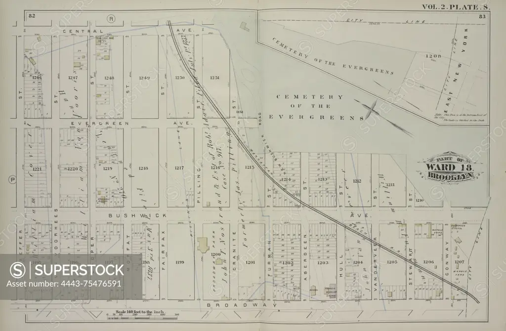
SuperStock offers millions of photos, videos, and stock assets to creatives around the world. This image of Map from Vol. 2, Plate S, published in 1880 by G.M. Hopkins & Co. The map is bound by Central Ave., Cemetery of the Evergreens, City Line, and Broadway, as well as Schaeffer St. It includes streets such as Evergreen Ave., Bushwick Ave., Van Voorhees St., Cooper St., Fairfax St., Pilling St., Granite St., Furman St., Aberdeen St., Hull St., Vanderveer St., Stewart St., and Conway St. The map is relevant to real property in Brooklyn, New York by Artokoloro is available for licensing today.
Looking for a license?
Click here, and we'll help you find it! Questions? Just ask!
Click here, and we'll help you find it! Questions? Just ask!
DETAILS
Image Number: 4443-75476591Rights ManagedCredit Line:Artokoloro/SuperStockCollection:Artokoloro Model Release:NoProperty Release:NoResolution:6286×4116