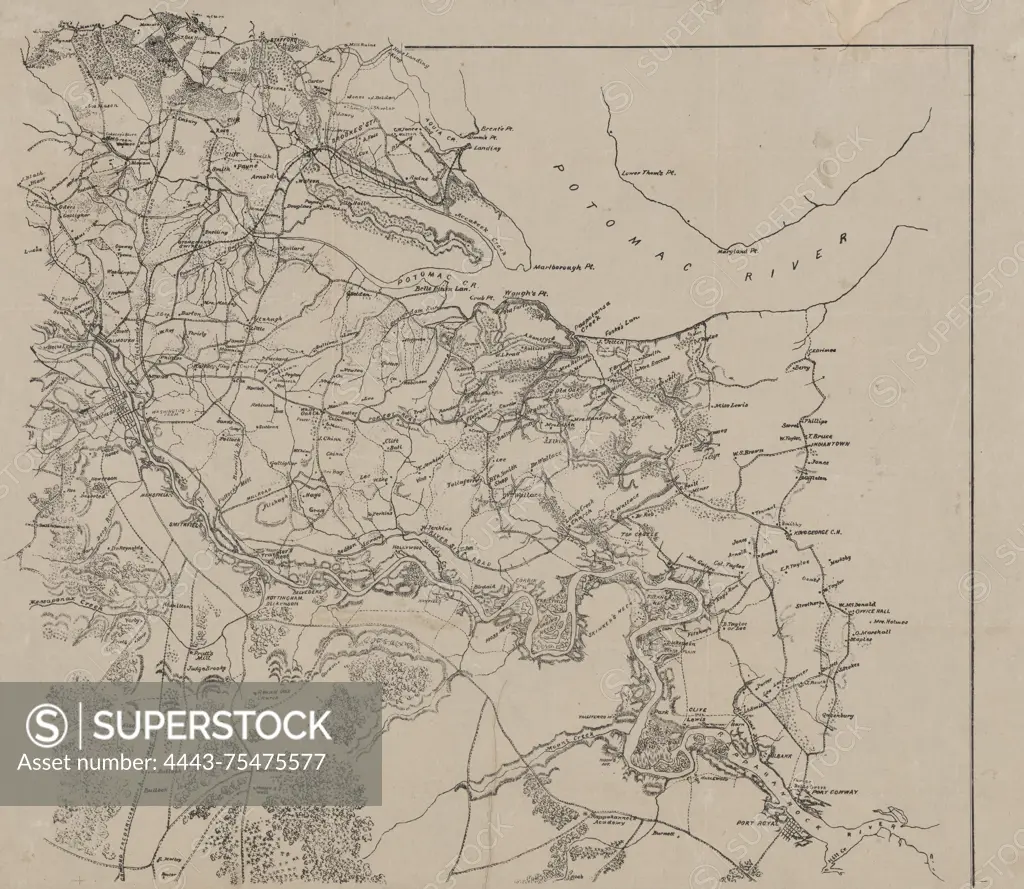
Map of Fredericksburg, Virginia, and its eastern vicinity, issued in 1862 by the Corps of Topographical Engineers. The map measures 46 x 57 cm and shows relief features indicated by hachures. The publication is associated with the Civil War era in Virginia, specifically focusing on Fredericksburg
SuperStock offers millions of photos, videos, and stock assets to creatives around the world. This image of Map of Fredericksburg, Virginia, and its eastern vicinity, issued in 1862 by the Corps of Topographical Engineers. The map measures 46 x 57 cm and shows relief features indicated by hachures. The publication is associated with the Civil War era in Virginia, specifically focusing on Fredericksburg by Artokoloro is available for licensing today.
Looking for a license?
Click here, and we'll help you find it! Questions? Just ask!
Click here, and we'll help you find it! Questions? Just ask!
DETAILS
Image Number: 4443-75475577Rights ManagedCredit Line:Artokoloro/SuperStockCollection:Artokoloro Model Release:NoProperty Release:NoResolution:5700×4950