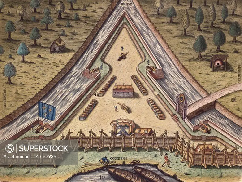
Map of Fort Caroline, built by second French expedition to Florida in 1564, leaded by RenŽ Goulaine de Laudonnire. 1591's painted version from a lost drawing by Jacques Le Moyne de Morgues. Engraving. FRANCE. ëLE-DE-FRANCE. Paris. Bibliothque du service historique de la Marine.
SuperStock offers millions of photos, videos, and stock assets to creatives around the world. This image of Map of Fort Caroline, built by second French expedition to Florida in 1564, leaded by RenŽ Goulaine de Laudonnire. 1591's painted version from a lost drawing by Jacques Le Moyne de Morgues. Engraving. FRANCE. ëLE-DE-FRANCE. Paris. Bibliothque du service historique de la Marine. by Iberfoto Archivo/Iberfoto is available for licensing today.
Looking for a license?
Click here, and we'll help you find it! Questions? Just ask!
Click here, and we'll help you find it! Questions? Just ask!
DETAILS
Image Number: 4435-7936Rights ManagedCredit Line:Iberfoto Archivo/Iberfoto/SuperStockCollection:Iberfoto Archivo Model Release:NoProperty Release:NoResolution:5040×3793