1755 map of the Forks of the Ohio, where the Monongahela and Allegany Rivers merge, becoming the Ohio River. On the left, at the confluence, is a diagram of Fort Duquesne, the French Fort that was the immediate cause of the French and Indian War, 1754-64 (BSLOC_2019_3_3)
This image has restrictions in United States, but still may be available. Get in touch for more details.
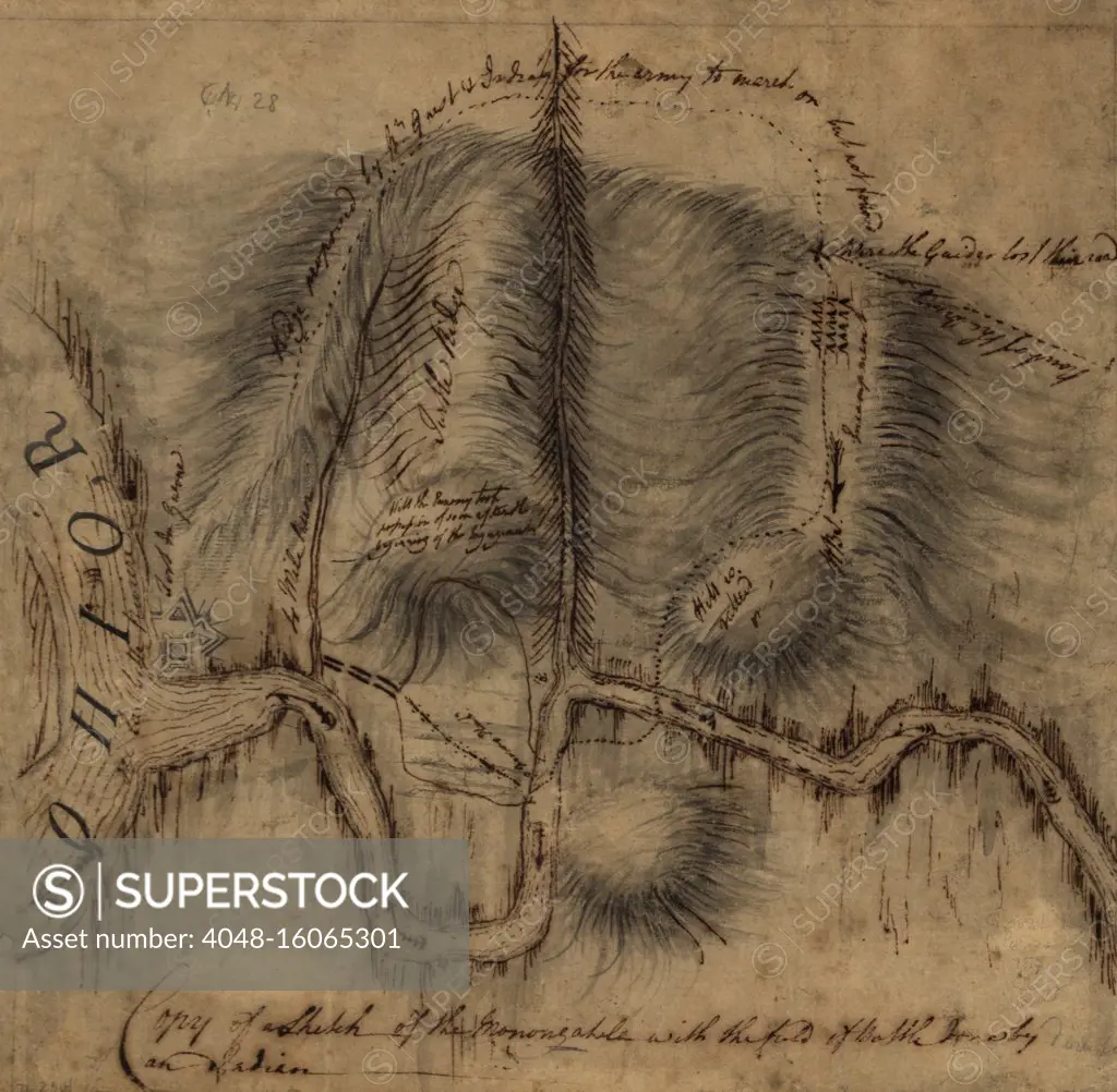
SuperStock offers millions of photos, videos, and stock assets to creatives around the world. This image of 1755 map of the Forks of the Ohio, where the Monongahela and Allegany Rivers merge, becoming the Ohio River. On the left, at the confluence, is a diagram of Fort Duquesne, the French Fort that was the immediate cause of the French and Indian War, 1754-64 (BSLOC_2019_3_3) by Everett Collection is available for licensing today.
DETAILS
Image Number: 4048-16065301Rights ManagedCredit Line:Everett Collection/SuperStockCollection:Everett Collection Model Release:NoProperty Release:NoResolution:3000×2936
Free Research
Can't find the usage you need?
We're here to help!
Phone:+1 866 236 0087
Email: help@superstock.com
or fill out a Contact Form
Research / License Request Form
Can't find the usage you need?
We're here to help!
Phone:
or fill out a Contact Form
Research / License Request Form
Retouching Services
Our MediaMagnet division offers comprehensive retouching services at great rates. For a free quote, please send us an e-mail and we'll get back to you promptly.
Email: Retouching Service
Our MediaMagnet division offers comprehensive retouching services at great rates. For a free quote, please send us an e-mail and we'll get back to you promptly.
Email: Retouching Service