Map of the Faeroe Islands. Administered by Denmark Date: early 18th century
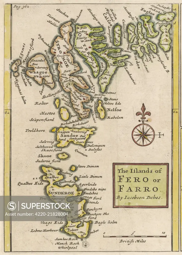
SuperStock offers millions of photos, videos, and stock assets to creatives around the world. This image of Explore the Historic Map of the Faroe Islands by Jacobus Debes: A Glimpse into Seafaring Navigation and Cartographic History. by Mary Evans Picture Library/Pantheon is available for licensing today.
Looking for a license?
Click here, and we'll help you find it! Questions? Just ask!
Click here, and we'll help you find it! Questions? Just ask!
DETAILS
Image Number: 4220-21828004Rights ManagedCredit Line:Mary Evans Picture Library/Pantheon/SuperStockCollection:Mary Evans Picture Library Model Release:NoProperty Release:NoResolution:3087×4324