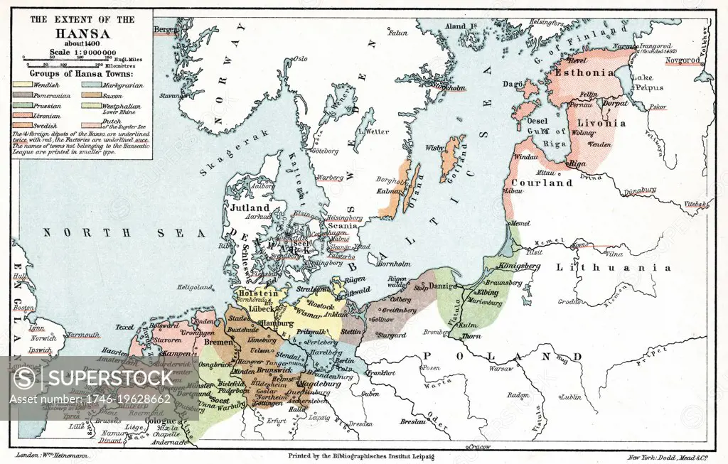
Map of the extent of the Hanseatic League in about 1400
SuperStock offers millions of photos, videos, and stock assets to creatives around the world. This image of Map of the extent of the Hanseatic League in about 1400 by World History Archive/Image Asset Management is available for licensing today.
Looking for a license?
Click here, and we'll help you find it! Questions? Just ask!
Click here, and we'll help you find it! Questions? Just ask!
DETAILS
Image Number: 1746-19628662Rights ManagedCredit Line:World History Archive/Image Asset Management/SuperStockCollection:Image Asset Management Contributor:World History Archive Model Release:NoProperty Release:NoResolution:6000×3832