Map of Europe according to the newest and most exact observations, issued in 1736. Published in London by Tho. Bowles, a print and map-seller in St. Paul's Churchyard. The map is hand-colored and measures 64 x 96 cm, folded to 64 x 28 cm
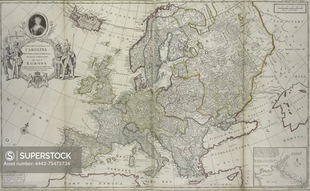
SuperStock offers millions of photos, videos, and stock assets to creatives around the world. This image of Map of Europe according to the newest and most exact observations, issued in 1736. Published in London by Tho. Bowles, a print and map-seller in St. Paul's Churchyard. The map is hand-colored and measures 64 x 96 cm, folded to 64 x 28 cm by Artokoloro is available for licensing today.
Looking for a license?
Click here, and we'll help you find it! Questions? Just ask!
Click here, and we'll help you find it! Questions? Just ask!
DETAILS
Image Number: 4443-75475734Rights ManagedCredit Line:Artokoloro/SuperStockCollection:Artokoloro Model Release:NoProperty Release:NoResolution:6211×3823