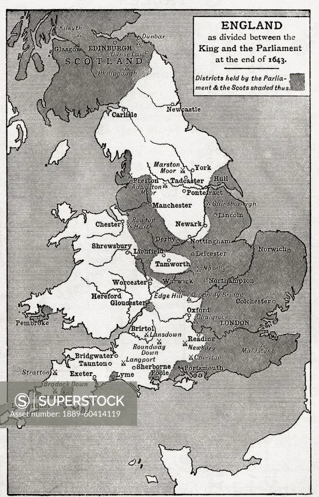
Map of England as divided between the king and the parliament at the end of 1643. The shaded areas are districts held by the parliament and the Scots. From Britain and Her Neighbours, 1485 - 1688, pu
SuperStock offers millions of photos, videos, and stock assets to creatives around the world. This image of Map of England as divided between the king and the parliament at the end of 1643. The shaded areas are districts held by the parliament and the Scots. From Britain and Her Neighbours, 1485 - 1688, pu by Hilary Jane Morgan/Design Pics is available for licensing today.
Looking for a license?
Click here, and we'll help you find it! Questions? Just ask!
Click here, and we'll help you find it! Questions? Just ask!
DETAILS
Image Number: 1889-60414119Rights ManagedCredit Line:Hilary Jane Morgan/Design Pics/SuperStockCollection:Design Pics Contributor:Hilary Jane Morgan Model Release:NoProperty Release:NoResolution:3426×5341