Map of the Eastern States to illustrate Olney's school geography, 1829. Published by D.F. Robinson & Co. in Hartford, Connecticut. The map features details such as battlefields, counties, railroads, and distances throughout New England and New York State. It is a hand-colored map measuring 23 x 19 cm on a sheet of 29 x 23 cm
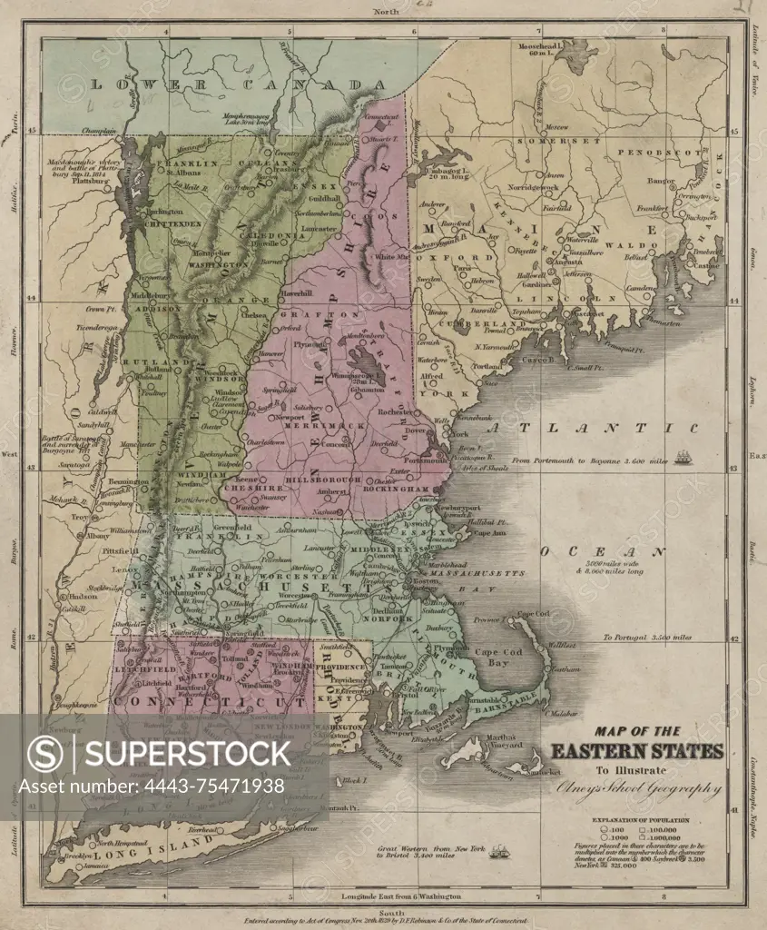
SuperStock offers millions of photos, videos, and stock assets to creatives around the world. This image of Map of the Eastern States to illustrate Olney's school geography, 1829. Published by D.F. Robinson & Co. in Hartford, Connecticut. The map features details such as battlefields, counties, railroads, and distances throughout New England and New York State. It is a hand-colored map measuring 23 x 19 cm on a sheet of 29 x 23 cm by Artokoloro is available for licensing today.
Looking for a license?
Click here, and we'll help you find it! Questions? Just ask!
Click here, and we'll help you find it! Questions? Just ask!
DETAILS
Image Number: 4443-75471938Rights ManagedCredit Line:Artokoloro/SuperStockCollection:Artokoloro Model Release:NoProperty Release:NoResolution:4708×5700