A map of the East Indies, derived from Mr. de Fer's Map of Asia, illustrating the primary divisions, cities, towns, ports, rivers, and mountains. Dated 1700, published in Oxford at the Sheldonian Theatre. Additional, East Indies. Related subjects include atlases, British geography, ancient maps, and their use in education
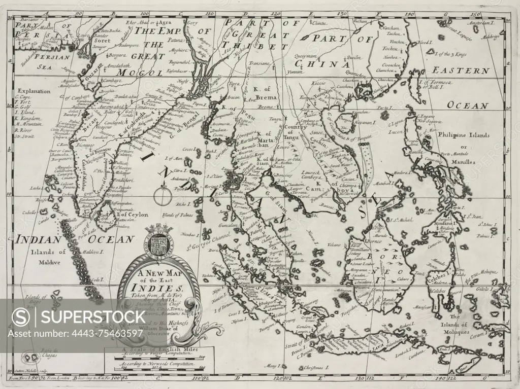
SuperStock offers millions of photos, videos, and stock assets to creatives around the world. This image of A map of the East Indies, derived from Mr. de Fer's Map of Asia, illustrating the primary divisions, cities, towns, ports, rivers, and mountains. Dated 1700, published in Oxford at the Sheldonian Theatre. Additional, East Indies. Related subjects include atlases, British geography, ancient maps, and their use in education by Artokoloro is available for licensing today.
Looking for a license?
Click here, and we'll help you find it! Questions? Just ask!
Click here, and we'll help you find it! Questions? Just ask!
DETAILS
Image Number: 4443-75463597Rights ManagedCredit Line:Artokoloro/SuperStockCollection:Artokoloro Model Release:NoProperty Release:NoResolution:4768×3575