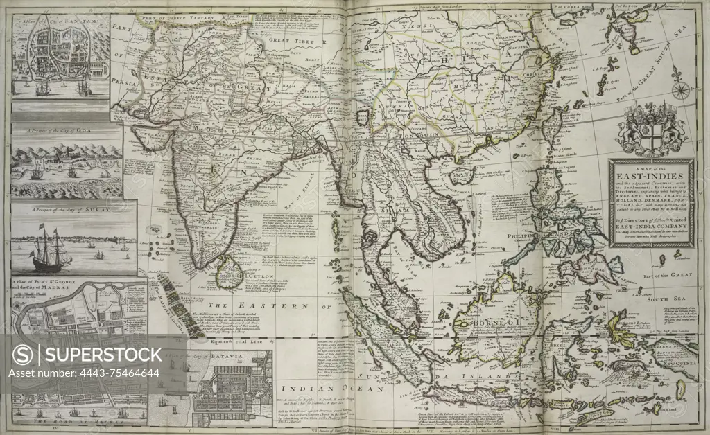
A map of the East-Indies and the adjacent countries, dated 1736. The map illustrates the settlements, factories, and territories, indicating what belongs to England, Spain, France, Holland, Denmark, Portugal, and others. It is hand-colored and measures 64 x 102 cm when unfolded, folded to 64 x 28 cm for distribution. The map was published in London by Tho. Bowles, a print and map-seller based in St. Paul's Churchyard
SuperStock offers millions of photos, videos, and stock assets to creatives around the world. This image of A map of the East-Indies and the adjacent countries, dated 1736. The map illustrates the settlements, factories, and territories, indicating what belongs to England, Spain, France, Holland, Denmark, Portugal, and others. It is hand-colored and measures 64 x 102 cm when unfolded, folded to 64 x 28 cm for distribution. The map was published in London by Tho. Bowles, a print and map-seller based in St. Paul's Churchyard by Artokoloro is available for licensing today.
Looking for a license?
Click here, and we'll help you find it! Questions? Just ask!
Click here, and we'll help you find it! Questions? Just ask!
DETAILS
Image Number: 4443-75464644Rights ManagedCredit Line:Artokoloro/SuperStockCollection:Artokoloro Model Release:NoProperty Release:NoResolution:6607×4058