Map of Doonik and surroundings, Anonymous, 1695 - 1726 print Map of Doonik and surroundings. At the top left a frame with legend 1-7. Under, to the right of the middle a bowl: Echelle de 400 Thoises. paper etching / engraving maps of separate countries or regions. maps of cities. fortified city Torlative
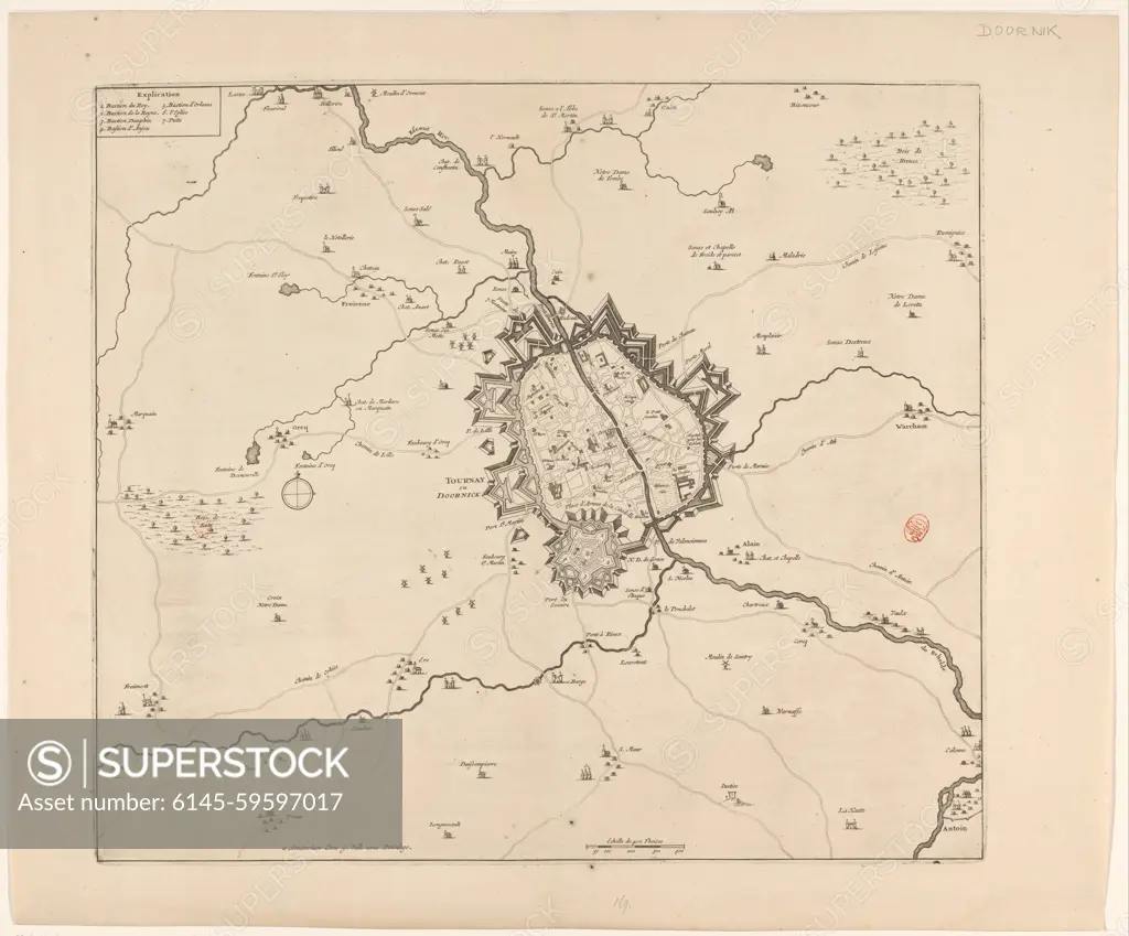
SuperStock offers millions of photos, videos, and stock assets to creatives around the world. This image of Map of Doonik and surroundings, Anonymous, 1695 - 1726 print Map of Doonik and surroundings. At the top left a frame with legend 1-7. Under, to the right of the middle a bowl: Echelle de 400 Thoises. paper etching / engraving maps of separate countries or regions. maps of cities. fortified city Torlative by Piemags/PL Photography Limited is available for licensing today.
Looking for a license?
Click here, and we'll help you find it! Questions? Just ask!
Click here, and we'll help you find it! Questions? Just ask!
DETAILS
Image Number: 6145-59597017Royalty FreeCredit Line:Piemags/PL Photography Limited/SuperStockCollection:PL Photography Limited Story:Historical Battle MapsContributor:Piemags Model Release:NoProperty Release:NoResolution:5518×4576