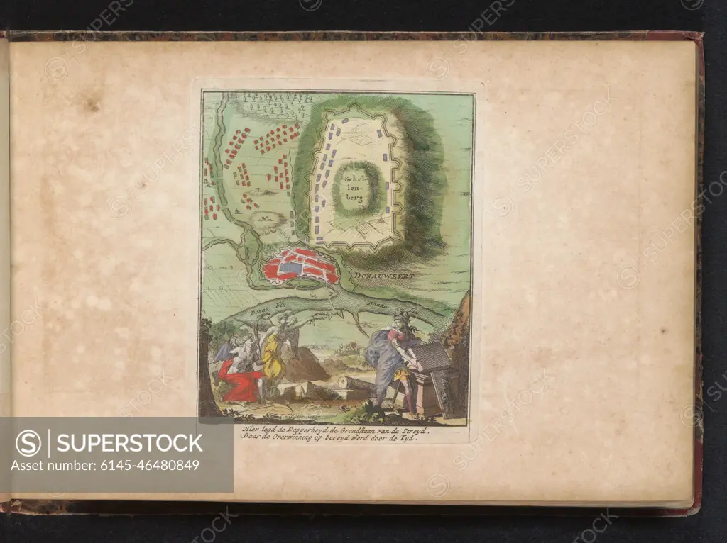
Map of Donauhörth Starting at De Schellenberg, 1704. Map of Donauhörth Starting at the Schellenberg between the Allies and the Beiersen and French, July 2, 1704. At the bottom of an allegorical scene with bravery, time and victory, with two-legged fresh. Part of an Atlas with 223 maps of countries and cities and war scaffolding in Europe in the period approx. 1690-1735.
SuperStock offers millions of photos, videos, and stock assets to creatives around the world. This image of Map of Donauhörth Starting at De Schellenberg, 1704. Map of Donauhörth Starting at the Schellenberg between the Allies and the Beiersen and French, July 2, 1704. At the bottom of an allegorical scene with bravery, time and victory, with two-legged fresh. Part of an Atlas with 223 maps of countries and cities and war scaffolding in Europe in the period approx. 1690-1735. by Piemags/PL Photography Limited is available for licensing today.
Looking for a license?
Click here, and we'll help you find it! Questions? Just ask!
Click here, and we'll help you find it! Questions? Just ask!
DETAILS
Image Number: 6145-46480849Royalty FreeCredit Line:Piemags/PL Photography Limited/SuperStockCollection:PL Photography Limited Contributor:Piemags Model Release:NoProperty Release:NoResolution:2500×1871