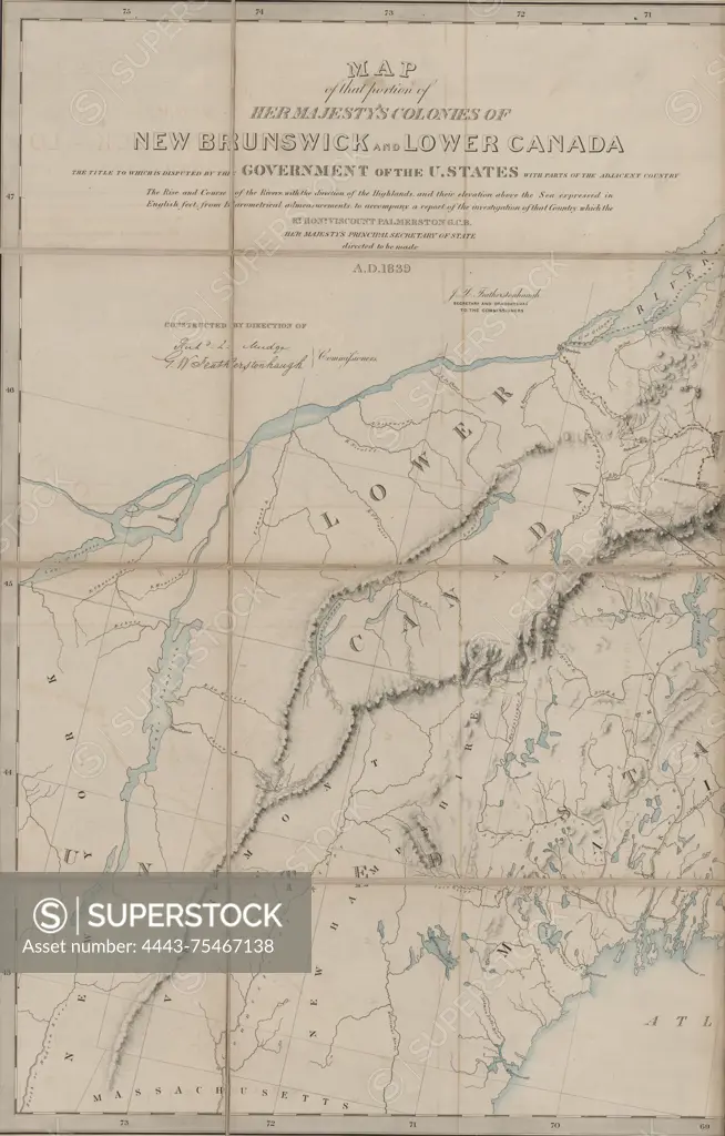
Map of the disputed territories in the colonies of New Brunswick and Lower Canada, published in 1840. The map highlights areas whose ownership is contested by the United States government and includes parts of the adjacent country. It features hand coloring and consists of 9 maps on 2 sheets, with dimensions of 79 x 124 cm and 50 x 78 cm. The map was published in London, England, by the Foreign Office and relates to boundary disputes between the United States and Great Britain
SuperStock offers millions of photos, videos, and stock assets to creatives around the world. This image of Map of the disputed territories in the colonies of New Brunswick and Lower Canada, published in 1840. The map highlights areas whose ownership is contested by the United States government and includes parts of the adjacent country. It features hand coloring and consists of 9 maps on 2 sheets, with dimensions of 79 x 124 cm and 50 x 78 cm. The map was published in London, England, by the Foreign Office and relates to boundary disputes between the United States and Great Britain by Artokoloro is available for licensing today.
Looking for a license?
Click here, and we'll help you find it! Questions? Just ask!
Click here, and we'll help you find it! Questions? Just ask!
DETAILS
Image Number: 4443-75467138Rights ManagedCredit Line:Artokoloro/SuperStockCollection:Artokoloro Model Release:NoProperty Release:NoResolution:3643×5700