A map displaying the countries and places mentioned in the New Testament. Created by Robert Sayer, this map was issued in 1788 in London and is a second edition with additions, corrections, and significant improvements. The creation year of the map is 1786 and it is categorized under early British atlases, produced prior to 1800, focusing on geography
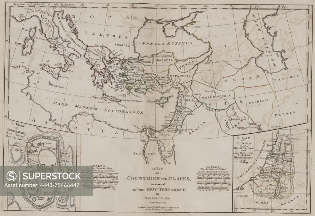
SuperStock offers millions of photos, videos, and stock assets to creatives around the world. This image of A map displaying the countries and places mentioned in the New Testament. Created by Robert Sayer, this map was issued in 1788 in London and is a second edition with additions, corrections, and significant improvements. The creation year of the map is 1786 and it is categorized under early British atlases, produced prior to 1800, focusing on geography by Artokoloro is available for licensing today.
Looking for a license?
Click here, and we'll help you find it! Questions? Just ask!
Click here, and we'll help you find it! Questions? Just ask!
DETAILS
Image Number: 4443-75466447Rights ManagedCredit Line:Artokoloro/SuperStockCollection:Artokoloro Model Release:NoProperty Release:NoResolution:6472×4449