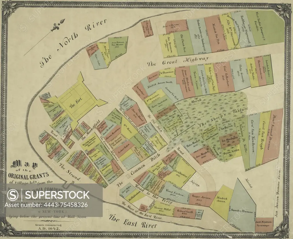
A map depicting the original grants of village lots from the Dutch West India Company to the inhabitants of New-Amsterdam (now New York), located below the current line of Wall Street. The grants date back to A.D. 1642. Issued in 1897, the map measures 40 x 50 cm and includes colored details. It focuses on real property in Manhattan, New York
SuperStock offers millions of photos, videos, and stock assets to creatives around the world. This image of A map depicting the original grants of village lots from the Dutch West India Company to the inhabitants of New-Amsterdam (now New York), located below the current line of Wall Street. The grants date back to A.D. 1642. Issued in 1897, the map measures 40 x 50 cm and includes colored details. It focuses on real property in Manhattan, New York by Artokoloro is available for licensing today.
Looking for a license?
Click here, and we'll help you find it! Questions? Just ask!
Click here, and we'll help you find it! Questions? Just ask!
DETAILS
Image Number: 4443-75458326Rights ManagedCredit Line:Artokoloro/SuperStockCollection:Artokoloro Model Release:NoProperty Release:NoResolution:4985×4074