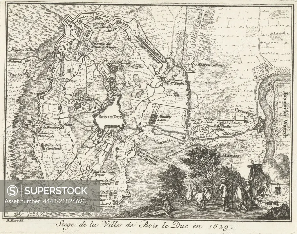
Map of Den Bosch and environs during the encirclement and siege by the State army under Frederick Henry, from May 1 to September 17, 1629 To the right in a foreground a scene of daily life in the army camp, Map of the siege of Den Bosch by Frederick Henry, 1629 Siege de la Ville de Bois le Duc en 1629 , print maker: anonymous, intermediary draughtsman: Bernard Picart, (mentioned on object), Northern Netherlands, 1683 - 1733, paper, etching, h 108 mm × w 139 mm
SuperStock offers millions of photos, videos, and stock assets to creatives around the world. This image of Map of Den Bosch and environs during the encirclement and siege by the State army under Frederick Henry, from May 1 to September 17, 1629 To the right in a foreground a scene of daily life in the army camp, Map of the siege of Den Bosch by Frederick Henry, 1629 Siege de la Ville de Bois le Duc en 1629 , print maker: anonymous, intermediary draughtsman: Bernard Picart, (mentioned on object), Northern Netherlands, 1683 - 1733, paper, etching, h 108 mm × w 139 mm by Artokoloro is available for licensing today.
Looking for a license?
Click here, and we'll help you find it! Questions? Just ask!
Click here, and we'll help you find it! Questions? Just ask!
DETAILS
Image Number: 4443-21826693Rights ManagedCredit Line:Artokoloro/SuperStockCollection:Artokoloro Model Release:NoProperty Release:NoResolution:4667×3671