MAP FOR THE DEFENSE PLAN OF THE SERRANIA BETWEEN CARACAS AND THE COAST OF GUAIRA - 1778. Author: CXAM AGUSTIN. Location: ARCHIVO HISTORICO MILITAR. MADRID. SPAIN.
This asset has restrictions and cannot be purchased online. Get in touch for more details.
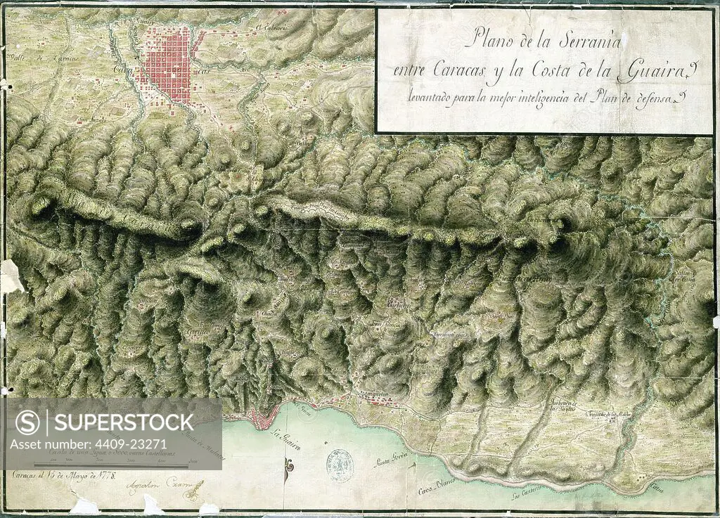
SuperStock offers millions of photos, videos, and stock assets to creatives around the world. This image of Explore Historical Cartography: Detailed 18th-Century Map of Caracas and the La Guaira Coastline. by Album/AFO/Album Archivo is available for licensing today.
Looking for a license?
Click here, and we'll help you find it! Questions? Just ask!
Click here, and we'll help you find it! Questions? Just ask!
DETAILS
Image Number: 4409-23271Rights ManagedCredit Line:Album/AFO/Album Archivo/SuperStockCollection:Album Archivo Contributor:Album / AFO Model Release:NoProperty Release:NoResolution:5910×4256