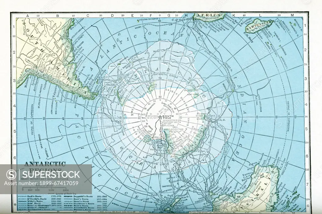
This map dates to the 1920s and shows the Antarctic regions, with the routes taken by various explorers between 1772 and 1914. The routes shown are those of Cook, D'Urville, Wilke, Ross, "Challenger," "Belgica," Borchgrevink, Drygalski, Scott, Bruce, Shackleton, Scott, Amundsen, and Mawson.
SuperStock offers millions of photos, videos, and stock assets to creatives around the world. This image of This map dates to the 1920s and shows the Antarctic regions, with the routes taken by various explorers between 1772 and 1914. The routes shown are those of Cook, D'Urville, Wilke, Ross, "Challenger," "Belgica," Borchgrevink, Drygalski, Scott, Bruce, Shackleton, Scott, Amundsen, and Mawson. by Ivy Close Images/Universal Images is available for licensing today.
Looking for a license?
Click here, and we'll help you find it! Questions? Just ask!
Click here, and we'll help you find it! Questions? Just ask!
DETAILS
Image Number: 1899-67417059Rights ManagedCredit Line:Ivy Close Images/Universal Images/SuperStockCollection:Universal Images Contributor:Ivy Close Images Model Release:NoProperty Release:NoResolution:5010×3328