A map of the Cumberland coal region from 1865, issued by the New York State Engineer and Surveyor. The map illustrates the relative positions of the coal mines in Allegany County, Maryland, and measures 20 x 25 cm or smaller, printed on a larger sheet measuring 20 x 55 cm. The design features blueline printing
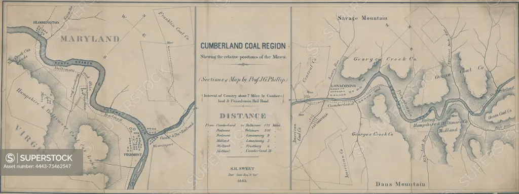
SuperStock offers millions of photos, videos, and stock assets to creatives around the world. This image of A map of the Cumberland coal region from 1865, issued by the New York State Engineer and Surveyor. The map illustrates the relative positions of the coal mines in Allegany County, Maryland, and measures 20 x 25 cm or smaller, printed on a larger sheet measuring 20 x 55 cm. The design features blueline printing by Artokoloro is available for licensing today.
Looking for a license?
Click here, and we'll help you find it! Questions? Just ask!
Click here, and we'll help you find it! Questions? Just ask!
DETAILS
Image Number: 4443-75462547Rights ManagedCredit Line:Artokoloro/SuperStockCollection:Artokoloro Model Release:NoProperty Release:NoResolution:5700×2134