Map no. I, created in 1747, accompanies a bill in the Chancery of New Jersey in the case of John, Earl of Stair, against Benjamin Bond. It was printed in New York by James Parker, with additional copies available from Benjamin Franklin in Philadelphia. The map, measuring 39 x 32 cm and folded to 35 x 21 cm, provides historical context related to land grants, boundaries, and Indian land transfers in New Jersey, specifically during the Colonial period (ca. 1600-1775)
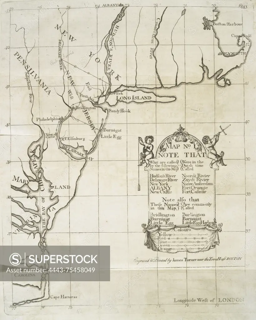
SuperStock offers millions of photos, videos, and stock assets to creatives around the world. This image of Map no. I, created in 1747, accompanies a bill in the Chancery of New Jersey in the case of John, Earl of Stair, against Benjamin Bond. It was printed in New York by James Parker, with additional copies available from Benjamin Franklin in Philadelphia. The map, measuring 39 x 32 cm and folded to 35 x 21 cm, provides historical context related to land grants, boundaries, and Indian land transfers in New Jersey, specifically during the Colonial period (ca. 1600-1775) by Artokoloro is available for licensing today.
Looking for a license?
Click here, and we'll help you find it! Questions? Just ask!
Click here, and we'll help you find it! Questions? Just ask!
DETAILS
Image Number: 4443-75458049Rights ManagedCredit Line:Artokoloro/SuperStockCollection:Artokoloro Model Release:NoProperty Release:NoResolution:3604×4492