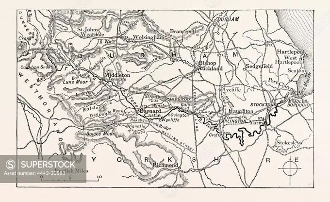
MAP OF THE COURSE OF THE TEES. The River Tees is in northern England. It rises on the eastern slope of Cross Fell in the North Pennines, and flows eastwards for 85 miles (137 km) to reach the North Sea between Hartlepool and Redcar near Middlesbrough. UK
SuperStock offers millions of photos, videos, and stock assets to creatives around the world. This image of MAP OF THE COURSE OF THE TEES. The River Tees is in northern England. It rises on the eastern slope of Cross Fell in the North Pennines, and flows eastwards for 85 miles (137 km) to reach the North Sea between Hartlepool and Redcar near Middlesbrough. UK by Artokoloro is available for licensing today.
DETAILS
Image Number: 4443-20588Rights ManagedCredit Line:Artokoloro/SuperStockCollection:Artokoloro Model Release:NoProperty Release:NoResolution:3789×2322