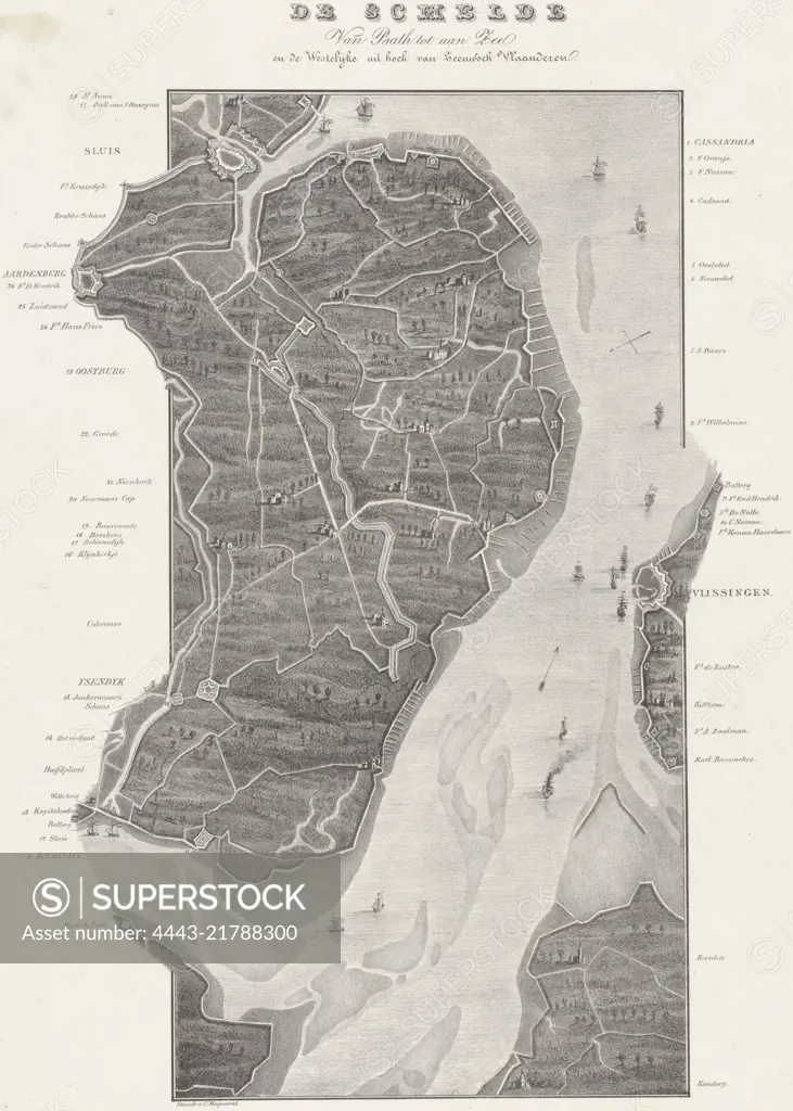
Map of the course of the Scheldt from Koudorp (bottom) to Sluis (top), at the time of the siege of Antwerp in December 1832. Along the river the various entrenchments and forts are indicated. The legend on either side of the representation 1-28. Map in two sheets, of which this is the upper part, Loop van de Schelde van Fort Bath tot zee (upper sheet), 1832 De Schelde Van Bath tot aan Zee. en de Westelijke uit hoek van Zeeuwsch Vlaanderen (title on object), print maker: Willem Charles Magnenat, (mentioned on object), publisher: Frans Buffa en Zonen, (mentioned on object), print maker: Netherlands, publisher: Amsterdam, 1833, paper, h 543 mm × w 380 mm
SuperStock offers millions of photos, videos, and stock assets to creatives around the world. This image of Map of the course of the Scheldt from Koudorp (bottom) to Sluis (top), at the time of the siege of Antwerp in December 1832. Along the river the various entrenchments and forts are indicated. The legend on either side of the representation 1-28. Map in two sheets, of which this is the upper part, Loop van de Schelde van Fort Bath tot zee (upper sheet), 1832 De Schelde Van Bath tot aan Zee. en de Westelijke uit hoek van Zeeuwsch Vlaanderen (title on object), print maker: Willem Charles Magnenat, (mentioned on object), publisher: Frans Buffa en Zonen, (mentioned on object), print maker: Netherlands, publisher: Amsterdam, 1833, paper, h 543 mm × w 380 mm by Artokoloro is available for licensing today.
Looking for a license?
Click here, and we'll help you find it! Questions? Just ask!
Click here, and we'll help you find it! Questions? Just ask!
DETAILS
Image Number: 4443-21788300Rights ManagedCredit Line:Artokoloro/SuperStockCollection:Artokoloro Model Release:NoProperty Release:NoResolution:3690×5167