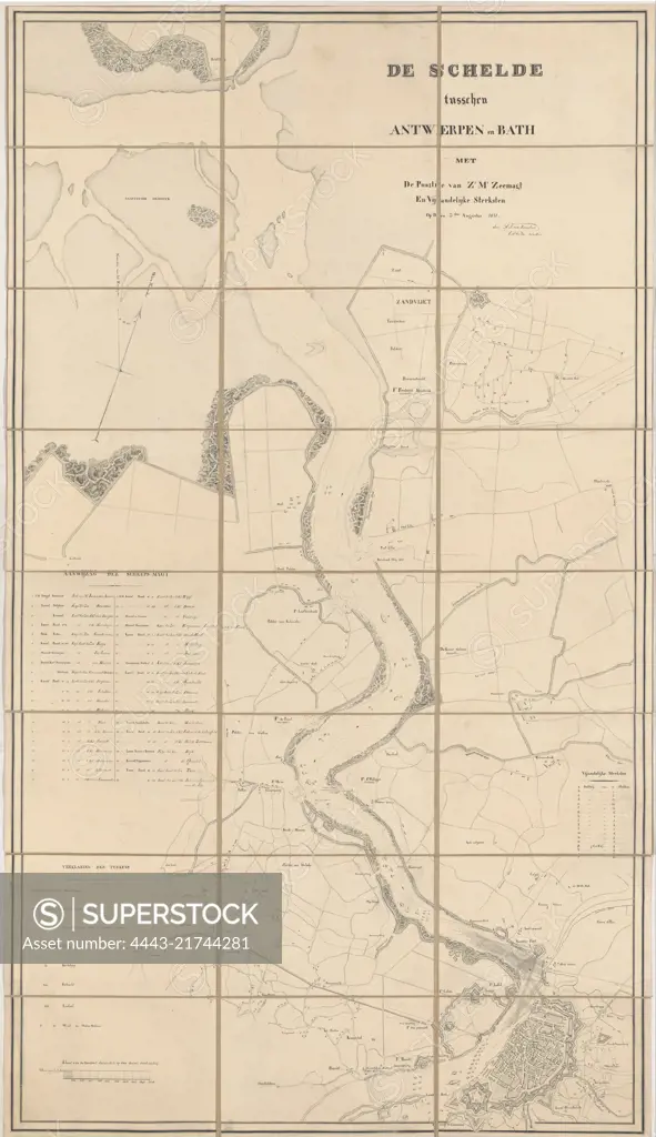
Map of the course of the river Scheldt between Fort Bath in Zeeland and the city of Antwerp on August 3, 1831. On the river the positions of the Dutch warships are indicated and numbered 1-40 (legend left). On the right the legend of the Belgian batteries along the riverbanks, Map of the Scheldt, 1831 The Scheldt between Antwerp and Bath with The Position of Sr Ms. Zeemagt and Enemy Strengths. On the 3rd of August, 1831, draughtsman: H.A. van Karnebeek, (signed by artist), Netherlands, 3-Aug-1831, paper, pen, h 1306 mm × w 746 mm
SuperStock offers millions of photos, videos, and stock assets to creatives around the world. This image of Map of the course of the river Scheldt between Fort Bath in Zeeland and the city of Antwerp on August 3, 1831. On the river the positions of the Dutch warships are indicated and numbered 1-40 (legend left). On the right the legend of the Belgian batteries along the riverbanks, Map of the Scheldt, 1831 The Scheldt between Antwerp and Bath with The Position of Sr Ms. Zeemagt and Enemy Strengths. On the 3rd of August, 1831, draughtsman: H.A. van Karnebeek, (signed by artist), Netherlands, 3-Aug-1831, paper, pen, h 1306 mm × w 746 mm by Artokoloro is available for licensing today.
Looking for a license?
Click here, and we'll help you find it! Questions? Just ask!
Click here, and we'll help you find it! Questions? Just ask!
DETAILS
Image Number: 4443-21744281Rights ManagedCredit Line:Artokoloro/SuperStockCollection:Artokoloro Model Release:NoProperty Release:NoResolution:5116×8858