Map of the county of Suffolk, created by Stone and Clark in 1829 and issued in 1839. The map is housed in Ithaca, N.Y., published by Stone and Clark, New York. It measures 45 x 83 cm and is hand-colored, folded to 50 x 44 cm
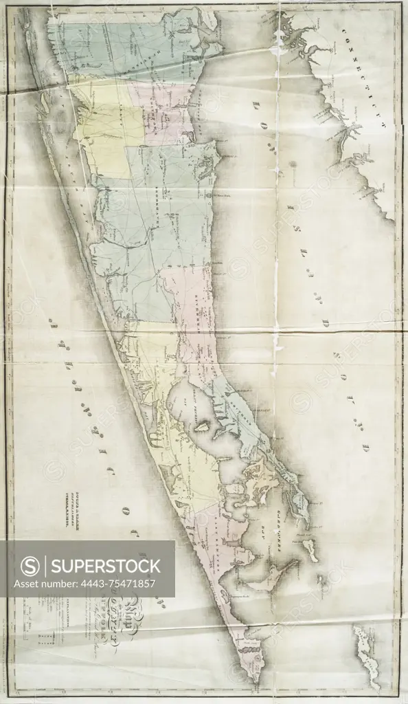
SuperStock offers millions of photos, videos, and stock assets to creatives around the world. This image of Map of the county of Suffolk, created by Stone and Clark in 1829 and issued in 1839. The map is housed in Ithaca, N.Y., published by Stone and Clark, New York. It measures 45 x 83 cm and is hand-colored, folded to 50 x 44 cm by Artokoloro is available for licensing today.
Looking for a license?
Click here, and we'll help you find it! Questions? Just ask!
Click here, and we'll help you find it! Questions? Just ask!
DETAILS
Image Number: 4443-75471857Rights ManagedCredit Line:Artokoloro/SuperStockCollection:Artokoloro Model Release:NoProperty Release:NoResolution:3196×5508