Map of the County of Rensselaer, 1841, by Stone & Clark. Issued in Ithaca, N.Y. This hand-colored map measures 45 x 30 cm and includes details about real property and landowners in Rensselaer County, New York
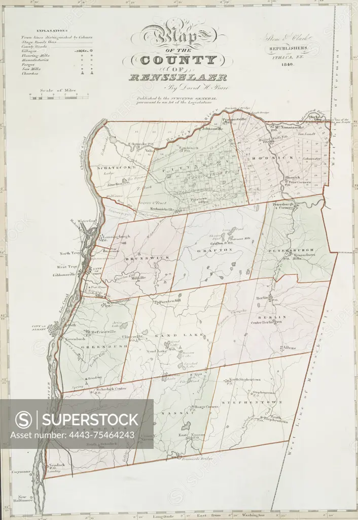
SuperStock offers millions of photos, videos, and stock assets to creatives around the world. This image of Map of the County of Rensselaer, 1841, by Stone & Clark. Issued in Ithaca, N.Y. This hand-colored map measures 45 x 30 cm and includes details about real property and landowners in Rensselaer County, New York by Artokoloro is available for licensing today.
Looking for a license?
Click here, and we'll help you find it! Questions? Just ask!
Click here, and we'll help you find it! Questions? Just ask!
DETAILS
Image Number: 4443-75464243Rights ManagedCredit Line:Artokoloro/SuperStockCollection:Artokoloro Model Release:NoProperty Release:NoResolution:2985×4326