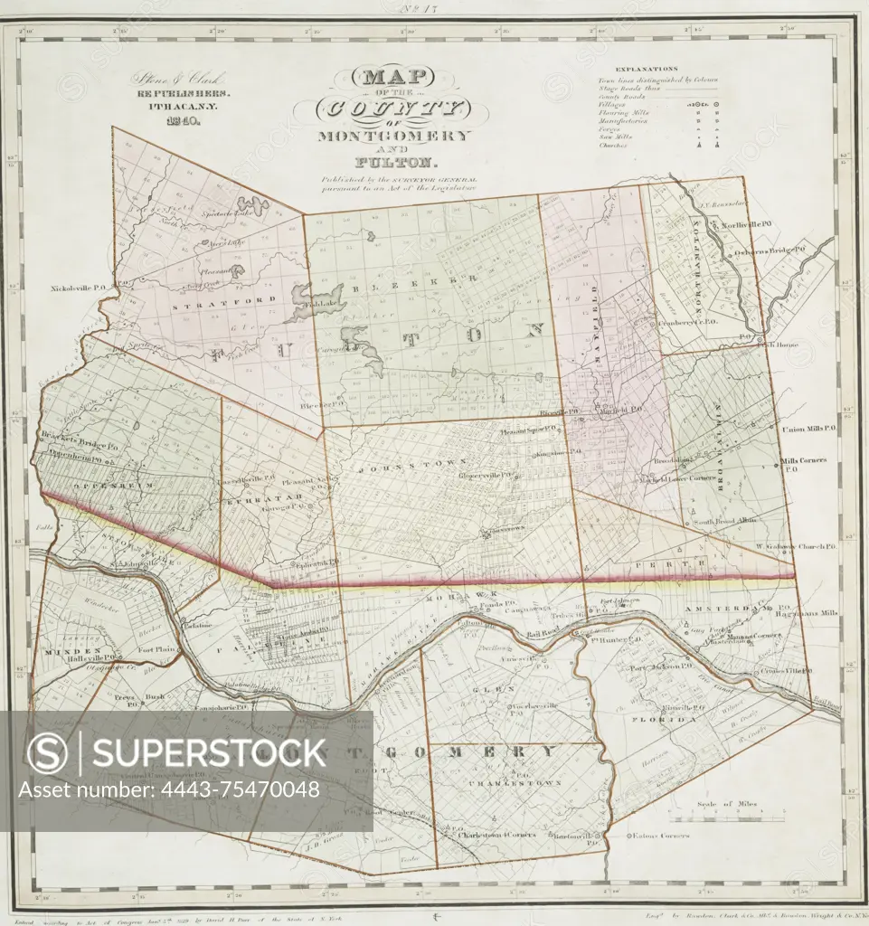
Map of the county of Montgomery and Fulton, 1841., 1841., Ithaca, N.Y. Publisher, Stone and Clark, New York (N.Y.). Covers real property and landowners in Fulton County and Montgomery County, New York., 1 map, hand-colored, 38 x 36 cm
SuperStock offers millions of photos, videos, and stock assets to creatives around the world. This image of Map of the county of Montgomery and Fulton, 1841., 1841., Ithaca, N.Y. Publisher, Stone and Clark, New York (N.Y.). Covers real property and landowners in Fulton County and Montgomery County, New York., 1 map, hand-colored, 38 x 36 cm by Artokoloro is available for licensing today.
Looking for a license?
Click here, and we'll help you find it! Questions? Just ask!
Click here, and we'll help you find it! Questions? Just ask!
DETAILS
Image Number: 4443-75470048Rights ManagedCredit Line:Artokoloro/SuperStockCollection:Artokoloro Model Release:NoProperty Release:NoResolution:3538×3767